PRIMUS is an international multidisciplinary project funded by ESA that aims to substantially advance our existing understanding on the link between net primary production (NPP) and wind-forced upwelling in Atlantic Eastern Boundary Upwelling Systems (EBUS), through combining Earth Observation (EO) data obtained from satellite remote sensing, with upwelling and climate indices, data collected in-situ, and ocean circulation modelling. Check out the rest of our website if you want to learn more about these topics, access new data and articles, and get involved with our research!
EBUS ARE IMPORTANT!
EBUS are some of the most productive regions of the ocean, providing critical ecological and socio-economical services for humans. Despite of occupying < 1% of the global ocean volume, EBUS produce up to 10% of the global marine NPP while supporting ~25% of the total worldwide fisheries, hence playing a considerable role in the cycling of carbon, oxygen, and nutrients in the global ocean. At the same time, EBUS are highly susceptible to environmental threats from human pressure and climate change. Unraveling how biology and physics interact in EBUS is crucial to create and implement adaptive management strategies dealing with the ecological and socio-economic effects of such threats.

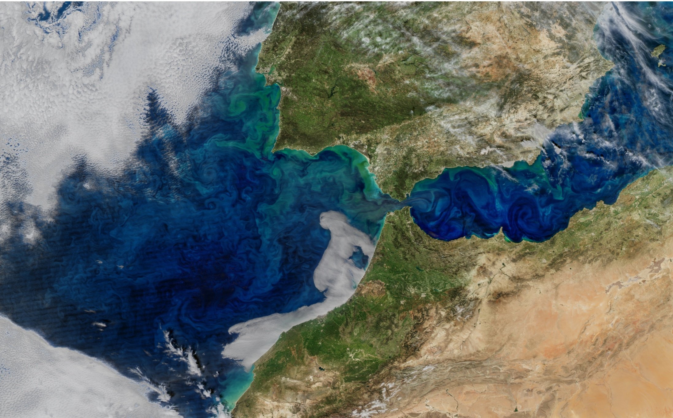
Iberia, Canary and Benguela upwelling regions (white ellipses) and respective in-situ sampling locations (red stars) which will be investigated in PRIMUS, with the surface distribution of Chl-a concentrations in the background.
ESA 4D ATLANTIC PROGRAM
PRIMUS is funded by the 4DAtlantic, a program developed by the European Space Agency (ESA) that aims at providing reliable and observation-based answers to major scientific and societal challenges of our times related to the impact of climate change on ocean health and marine ecosystems. The 4DAtlantic aims to complement on-going research within the ESA Ocean Science Cluster, and to positively contribute to the goals of The UN Decade of Ocean Science for Sustainable Development (2021-2030).
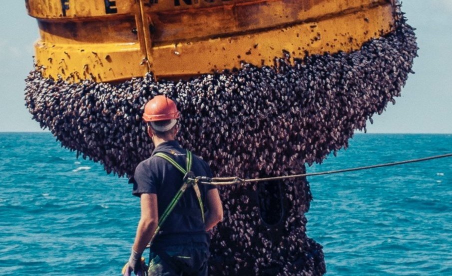
Multiparametric surface buoy completely covered by gooseneck barnacles which had overgrown during the spring bloom offshore Cape Blanc, NW Africa, in 2016.
PRIMUS ROADMAP
Based on a 25-year time series of 1-km NPP along the NE Atlantic and, experimentally, at higher-resolution (300 m), provided by the unique capabilities of ESA MERIS and ESA/Copernicus Sentinel 3 OLCI instruments, PRIMUS will contribute to advance existing understanding of Atlantic EBUS NPP in relation to upwelling and climate, while addressing its socio-economic impacts. In PRIMUS we will investigate the characteristics of the Canary Current system (including the Galician Rias and the Portuguese coast, in the Iberian Península) and the Benguela Current system, flowing along the eastern flank of the North and South Atlantic Ocean subtropical gyres, respectively.

call for action!
PRIMUS will maximize the scientific and societally relevant outputs of the 4DAtlantic datasets through nine study cases addressing science questions of relevance to EBUS. If you want to learn more about them and get involved with our research, feel free to explore our website and contact us for more information! This space was created for our team to share our discoveries, and to update you on the evolution of the project, new events, as well as “fresh” articles and data resulting from PRIMUS. So stay tuned for that as well!
RECENT POSTS FROM OUR NEWS BLOG!